Gardyloo
No longer a newbie, moving up!
- Joined
- May 10, 2020
- Messages
- 240
- Reaction score
- 530
- Location
- Seattle
- Can others edit my Photos
- Photos OK to edit
This thread - The Meeting of the Three Waters - inspired me to head to the vault and post some images I took on a day trip into the northern Scottish Highlands a few years ago. I was in Scotland visiting old friends for a few days and had a couple of additional days that became available, so I headed back to some parts of the country I hadn't visited in a long time. On one of those days I did a loop drive out of Inverness up to the north coast, and included a visit to a couple of historic sites, with a fairly large age gap between them - roughly 2800 years. Here's the route if interested: Google Maps
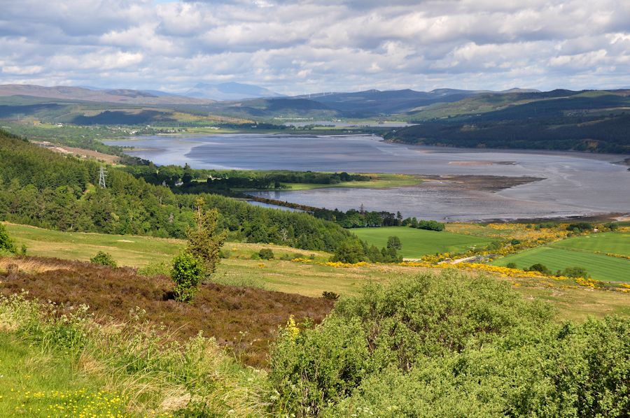
Struie Hill, overlooking the inner Dornoch Firth
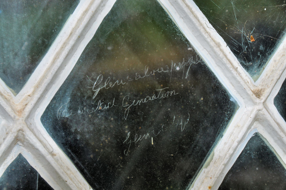
The first historic site was the old church at Croick, in an isolated spot in Strathcarron, a wide and quite empty valley. The church (or kirk) is noteworthy from the role it played during the infamous Highland Clearances that followed the 1745 Jacobite rebellion. Families of Highlanders, who had lived and worked on the land for centuries, were evicted to make way for sheep farming. Many of the local families were forced to stay in the Croick churchyard while they awaited transport out of the region - often to Glasgow, or to the coast, or in many cases to the West Indies and North America.
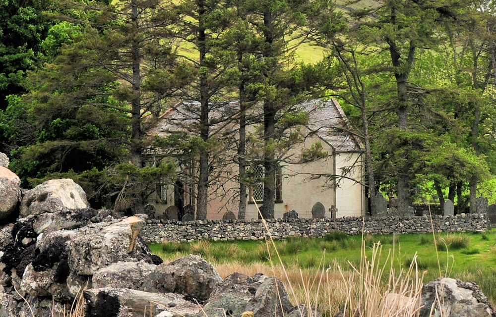
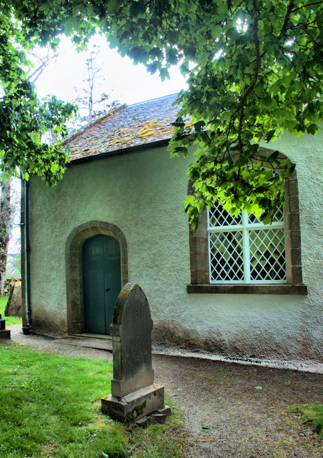
While they were waiting for their forced relocation, some scratched messages in the window panes of the church, which are still visible. Some of them reflect the sense of guilt the church and landlords attempted to inflict on them; they were told their eviction was punishment for their past sins (such as supporting the rebellion.)
As a result of these clearances, the region now appears almost completely depopulated, with some evidence of previous residents still visible.
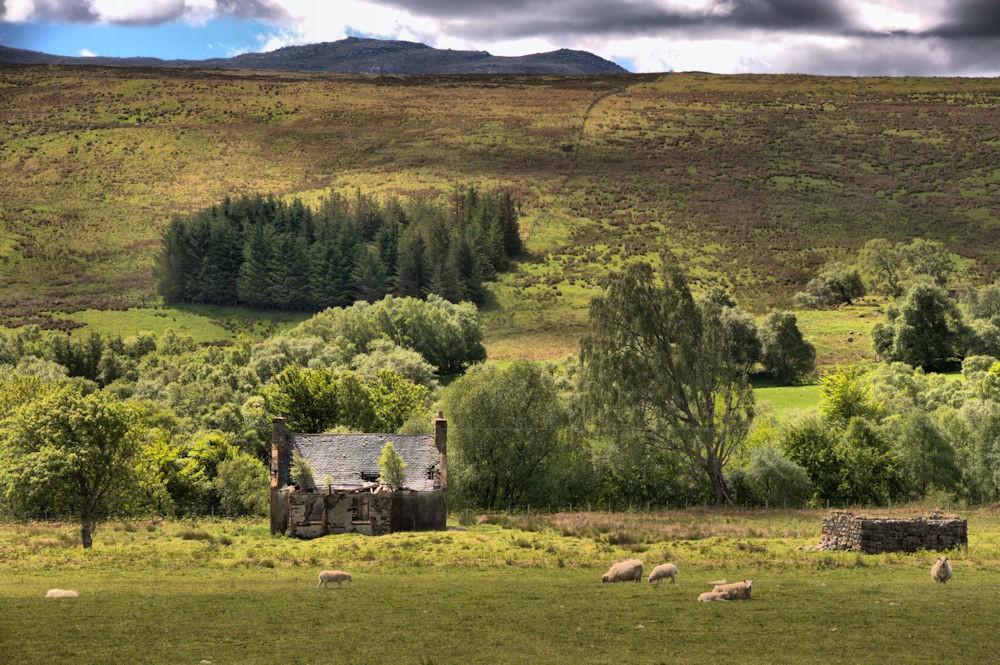
Of course not everyone fared poorly from these actions, in particular the landowners.
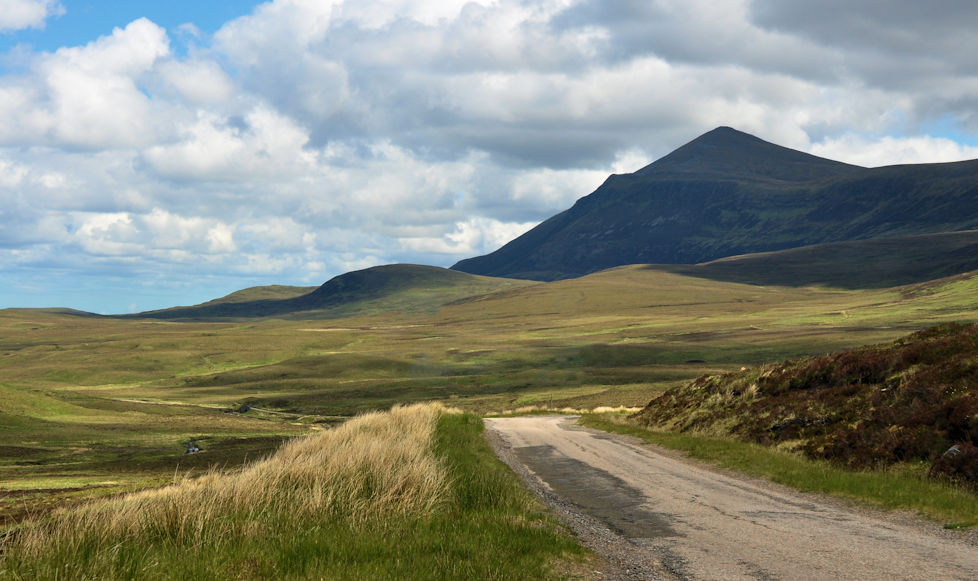
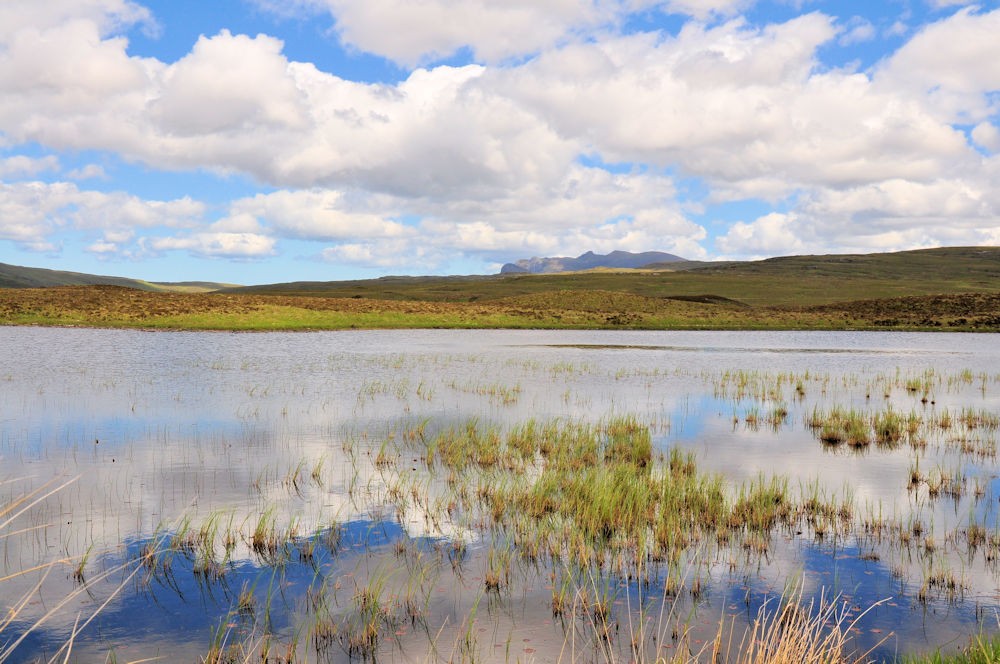
I then headed north through extremely empty country, aiming for my second historic site, a prehistoric broch or fortress sitting along the side of a road so remote and tiny that it lacks an official designation.
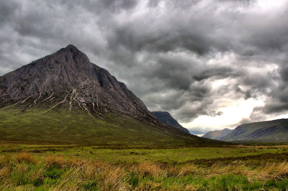
The landscape is beautiful, wild, and lonely.

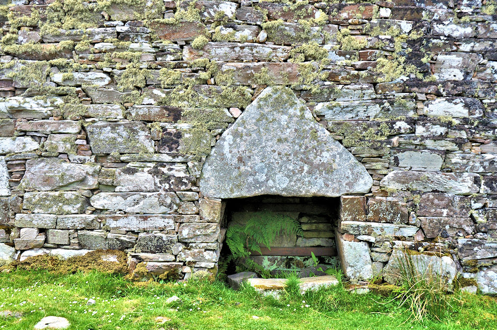
Broch Dun Dornaigil sits next to the road. It was probably built around 1000 BC but nobody's certain. It was a hollow "beehive" shaped structure, now partially collapsed. It just sits there in a valley where the only noise is the wind and distant sheep.
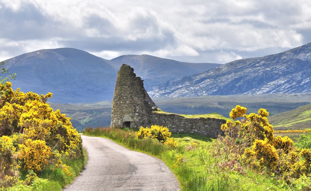
The triangular keystone over the low entrance is fairly impressive when one considers it was put into place with nothing but muscle power.
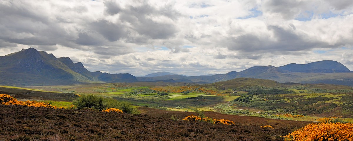
I then went up to the village of Tongue, on the north coast, before turning south to return to Inverness. Just south of the village the panorama of the countryside, with Ben Loyal and Ben Hope bracketing the various glens and straths, was impressive.
Struie Hill, overlooking the inner Dornoch Firth
The first historic site was the old church at Croick, in an isolated spot in Strathcarron, a wide and quite empty valley. The church (or kirk) is noteworthy from the role it played during the infamous Highland Clearances that followed the 1745 Jacobite rebellion. Families of Highlanders, who had lived and worked on the land for centuries, were evicted to make way for sheep farming. Many of the local families were forced to stay in the Croick churchyard while they awaited transport out of the region - often to Glasgow, or to the coast, or in many cases to the West Indies and North America.
While they were waiting for their forced relocation, some scratched messages in the window panes of the church, which are still visible. Some of them reflect the sense of guilt the church and landlords attempted to inflict on them; they were told their eviction was punishment for their past sins (such as supporting the rebellion.)
As a result of these clearances, the region now appears almost completely depopulated, with some evidence of previous residents still visible.
Of course not everyone fared poorly from these actions, in particular the landowners.
I then headed north through extremely empty country, aiming for my second historic site, a prehistoric broch or fortress sitting along the side of a road so remote and tiny that it lacks an official designation.
The landscape is beautiful, wild, and lonely.
Broch Dun Dornaigil sits next to the road. It was probably built around 1000 BC but nobody's certain. It was a hollow "beehive" shaped structure, now partially collapsed. It just sits there in a valley where the only noise is the wind and distant sheep.
The triangular keystone over the low entrance is fairly impressive when one considers it was put into place with nothing but muscle power.
I then went up to the village of Tongue, on the north coast, before turning south to return to Inverness. Just south of the village the panorama of the countryside, with Ben Loyal and Ben Hope bracketing the various glens and straths, was impressive.
Last edited:


![[No title]](/data/xfmg/thumbnail/39/39480-e4e26ffe5c6148262ac81eff975a5c0e.jpg?1619739047)