
fadingaway1986
I Burn Easily :(
- Joined
- Feb 4, 2004
- Messages
- 1,449
- Reaction score
- 9
- Location
- Queensland, Australia
- Website
- www.06photography.com
- Can others edit my Photos
- Photos OK to edit
Hi everyone. I am not exactly new, but have not posted for a LONG time...
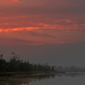
I just thought I would post some photos of Brisbane's recent flooding, and also the drought. Sadly I couldn't take the photos in the same places, as where I was standing was completely under water, but you will get the general idea I hope.

August 2007 - This is where you normally launch your boat. They extended the ramp down when there was still some water there, but that is useless aswell at this point.

October 2010 - This is where the boat ramp SHOULD be, but it is now completely under water. This is not the highest level that the dam was at, however once it got a bit higher than this, they locked the place up and that was the end of it.

August 2007 - Just a little bit to the right of the boat ramp.

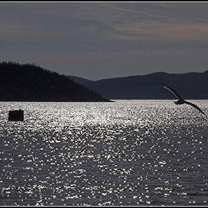
April 2009 - This is the main part of the Dam.

October 2010 - From roughly the same place as the previous photo. (notice the seat is now under water?) While we were there a seat disappeared before our eyes. We could see it when we pulled up, but when I walked over to take a photo, it was gone. We could not see it at all.
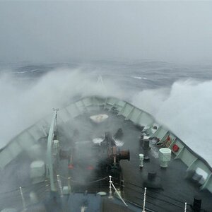
Now, for the most recent floods. I was not able to get anywhere near those places. Every single way out of the suburb I live in, was cut off by water. We were trapped there for 2 days before this following bridge opened enough for us to leave. Even then it was a few more days before any of the other routes opened up.

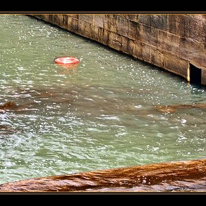
See the people on the otherside? They weren't trapped, they were just gawking at us. haha. I am not sure why that truck in the middle is there, but it was there the whole time.

That behind me is the main road. At the moment they are doing Roadworks, so there are a lot of roads there, but the one I am standing on is the one currently being used. I couldn't miss the opportunity to walk along the main road")
And finally:

This is the carpark of the shopping centre where I work. For the record, we really aren't very close to the river at all. The suburb next to us lost a LOT of houses and businesses.
If you have a look at PhotoMaps by NearMap it will show you the shopping centre (bottom left corner) and the floods near it. This was taken the day after the flood was at its peak, so it has gone down a lot.
I just thought I would post some photos of Brisbane's recent flooding, and also the drought. Sadly I couldn't take the photos in the same places, as where I was standing was completely under water, but you will get the general idea I hope.
August 2007 - This is where you normally launch your boat. They extended the ramp down when there was still some water there, but that is useless aswell at this point.
October 2010 - This is where the boat ramp SHOULD be, but it is now completely under water. This is not the highest level that the dam was at, however once it got a bit higher than this, they locked the place up and that was the end of it.
August 2007 - Just a little bit to the right of the boat ramp.
April 2009 - This is the main part of the Dam.
October 2010 - From roughly the same place as the previous photo. (notice the seat is now under water?) While we were there a seat disappeared before our eyes. We could see it when we pulled up, but when I walked over to take a photo, it was gone. We could not see it at all.
Now, for the most recent floods. I was not able to get anywhere near those places. Every single way out of the suburb I live in, was cut off by water. We were trapped there for 2 days before this following bridge opened enough for us to leave. Even then it was a few more days before any of the other routes opened up.
See the people on the otherside? They weren't trapped, they were just gawking at us. haha. I am not sure why that truck in the middle is there, but it was there the whole time.
That behind me is the main road. At the moment they are doing Roadworks, so there are a lot of roads there, but the one I am standing on is the one currently being used. I couldn't miss the opportunity to walk along the main road
And finally:
This is the carpark of the shopping centre where I work. For the record, we really aren't very close to the river at all. The suburb next to us lost a LOT of houses and businesses.
If you have a look at PhotoMaps by NearMap it will show you the shopping centre (bottom left corner) and the floods near it. This was taken the day after the flood was at its peak, so it has gone down a lot.
![[No title]](/data/xfmg/thumbnail/39/39291-a89dc472765e04f66f617dd9acc8030d.jpg?1619738958)
![[No title]](/data/xfmg/thumbnail/39/39289-c5ea6a611707fdd5786347f4a67d63ae.jpg?1619738957)
![[No title]](/data/xfmg/thumbnail/39/39288-2d76486ccc9042c6fb525aaaaffff1fb.jpg?1619738957)
![[No title]](/data/xfmg/thumbnail/40/40285-2ce5915035c220ccb3485030863b62d0.jpg?1619739408)