seeing all photos taken on a map (based GPS tag)

kolarmi

TPF Noob!
Joined
Dec 19, 2022
Messages
2
Reaction score
0
hey i used to use acdsee for that feature but this software is sucks,
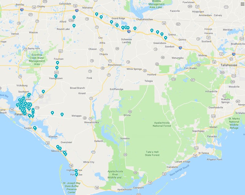
what software can do it? display all photos on a certain folder on a map?
not just one photo, but selecting few folders, while the software displays them all together on a map.
MAP.jpg
 
My experience with this, using the cell phone camera, has been that the location info in the photo is not necessarily GPS, but cell tower information, and thus sometimes a couple of miles off of actual. Of course, a GPS locator on a dSLR would be GPS...

I've actually not done it with thumbnails of the photos, but just to drop pins at the locations. The only time I've actually done anything like this was to drop pins for my own reference where I took pictures of the Hurricane Micheal aftermath in 2018-19. I didn't do this automatically, but with a tedious process of looking at the location info for each image and refining it when it was obviously a ways off, so I can't advise about software. My info here is simply to give an awareness that a cell phone's location info on an image isn't necessary very accurate.
47981475072_bcbbe95f7d_c.jpg


48507211196_8475454697_z.jpg
 
I'd use ArcGIS Online and make a Story Map, but I have an account through work. Maybe look into something like Google Earth. QGIS is free and open source but I'm not sure how flexible it is for something like this, or the learning curve.
 
i mean just quickly view them on a map. i think qgis and arcgis are software you need to create a newproject and start work.
 

Most reactions

New Topics

Back
Top