I'm in.
Our numbers have changed to 5" to 6" / 13cm to 15cm on Sunday and 8" to 10" / 20cm to 25cm on Monday.
I'll take a baseline photo, in a bit, of what is still here from before (Christmas Eve and a few smaller snows).
They can't decide on us. According to the forecast we might/might not have a winter storm weather event (changes every hour and different between forecasters). We should maybe/maybe not be prepared for freezing rain, with an accumulation of ice from absolutely nothing to Hell will freeze over.
Let's see.......10 degrees and 5-10 inches of snow by Monday. Nope, not going outside till maybe Tuesday. As private Hudson said in Aliens...."You can count me out!"
As of 3pm EST, we're clocking -22F windchill. Some squalls but mostly clear blue skies. Out for a 5k walk around 7am. Bearable but only because it was calm. Saturday and Sunday are looking like
"Snow-mageddon" for S. Ontario according to Environment Canada. Food+booze re-ups done. Jump pacs charged to revive flat car batteries. Funny how big drops revitalize neighborhood connections or make new ones. Everyone's your friend if you have a regulation-size snowblower!
It looks like we may start getting it about 4:00 PM Eastern on Sunday and stop around 1:00 PM on Monday. Then a blast again from 5:00 PM to 9:00 PM. I want to take 30 minute interval shots of the north corner of the parcel from the pantry room. After 2:00 on Monday, I’ll wander around the neighborhood with the Nikon.
It looks like we may start getting it about 4:00 PM Eastern on Sunday and stop around 1:00 PM on Monday. Then a blast again from 5:00 PM to 9:00 PM. I want to take 30 minute interval shots of the north corner of the parcel from the pantry room. After 2:00 on Monday, I’ll wander around the neighborhood with the Nikon.
Yup, will pocket the little Ricoh in a woolly sock+batt. on Sunday.No clue up here yet whether the worst will drift south. Likely still polar temps--snow or no snow. As my sainted MIL would say, "...a character-building exercise."
So this morning we are -23 Celcius (-9.4 Fahrenheit) with a windchill of -33 Celcius (-27.4 Fahrenheit) YIKES! oh and snow forecast for Sunday is 12"-16" !
So far all the winter weather is going north of us. Just reported that I65 about 90 miles NW of us is shut down due to ice. Hope it stays that way, 34F (for now)
We warmed up a bit. Went from -2F/-18.8C to 0F/-17.7C. Wind is 12mph/19.3kmph with gusts of 27mph/43.5kmph.
Still on for Sunday afternoon through Monday afternoon.
Heading out for some pre-storm shots of soemthing (maybe lighthouses) so I'll see what I-95 is like. The state sets maximum speed limit to 45mph / 74kmph when the road conditions are bad. I've had it happen to me twice: once during a snow last winter, and once for icy conditions a couple weeks ago; Slip Sliding Away (Paul Simon)
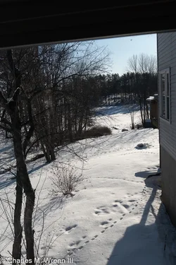
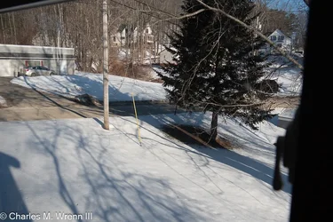
Here are a couple base-line shots of what we have on the ground right now. First is the side yard, back yard, and piece of the pond from the pantry, last is the north corner of the property with the pine tree. I'm going to try time-release shots of the tree.